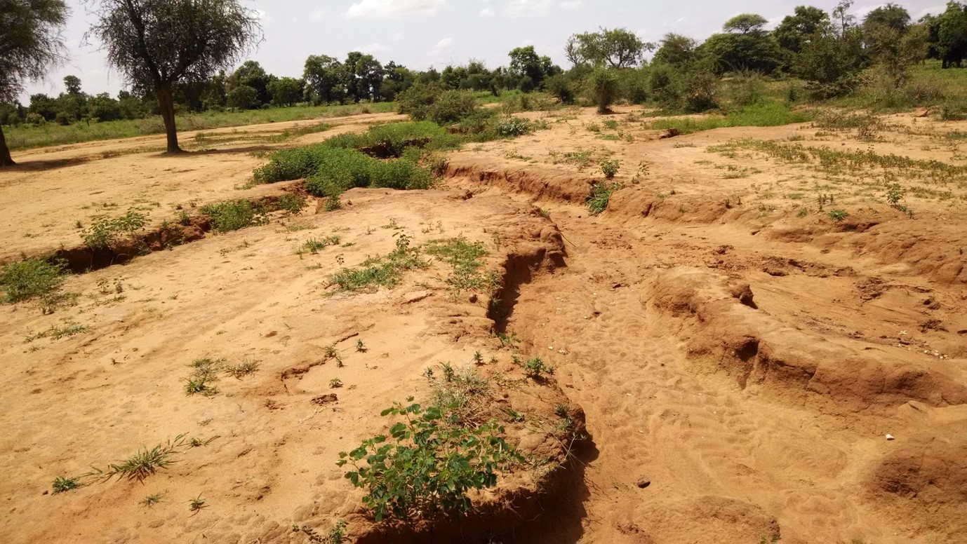
Gullies and zipellé soils such as these are common features of the local landscape – Photo: C. T. West
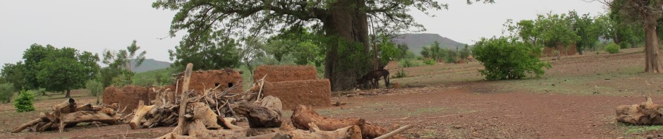
The northern Central Plateau region of Burkina Faso is an area characterized by high population densities, erratic rainfall and widespread land degradation. The gullies in the photo above are found throughout the region. They commonly occur in zipellé soils, which is a term Mossi farmers use to refer to totally exhausted bare soils where nothing grows. Mossi farmers have actively sought to rehabilitate areas like this through investments in improved agricultural techniques. I have been using secondary remote sensing and GIS data to assess the landscape impacts of these improved agricultural practices.
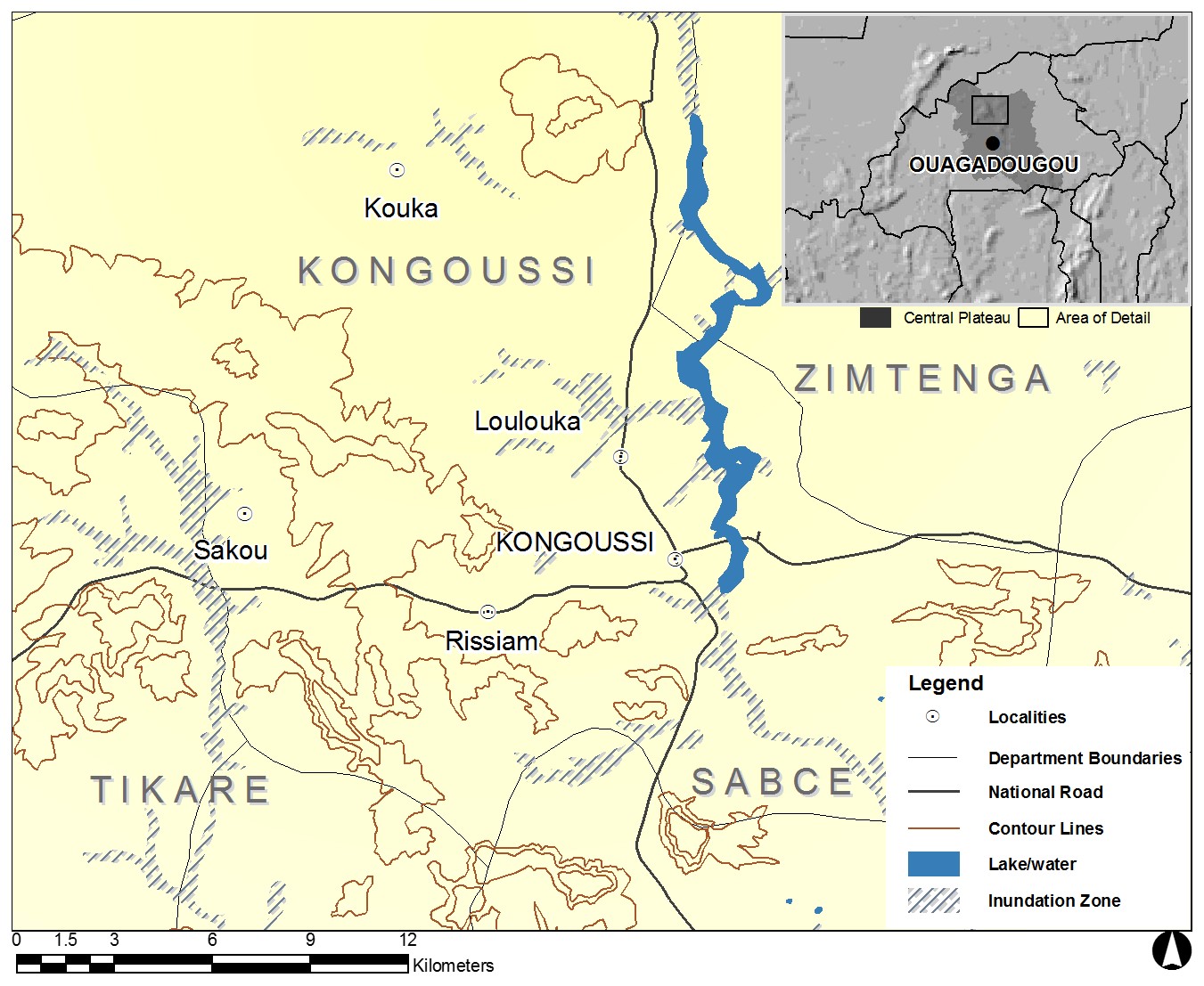
Map: Study Region and Inset Map of Northern Central Plateau, BF
Through partnerships with regional NGOs, international development organizations, and the Government of Burkina Faso, Mossi communities have invested heavily in a variety of Soil and Water Conservation (SWC) activities. These include the following:
Contour Stone Bunds (“diguettes“): Contour stone bunds are low level rock barriers that extend along the contour of agricultural fields. They prevent sheet erosion, slow runoff, and conserve organic matter. Tree, shrub and grass seeds become trapped along diguettes where they then germinate and grow. This leads to the spontaneous regeneration of native plants. Diguettes are widespread in the northern Central Plateau region and have become prominent features of the local landscape. As one Mossi farmer in Loulouka stated:
“These diguettes are not for me. They are for my children. Because of these investments, they will never know famine” (May, 2004).
Contour stone bunds, also commonly called “diguettes,” appear in the foreground – Photo: C. T. West
Zaï: Zaï (also referred to as zaï holes) are a Mossi indigenous technique of rehabilitating degraded soils. Smallholders dig shallow pits during the dry season and leave a low berm of soil on the down-slope side of each hole. As the rains commence, farmers place millet and sorghum seeds in each zaï along with a small amount of compost and cover this mixture with soil. This technique conserves moisture and improves the ability of cereal crops to withstand dry spells or droughts. It allows households to efficiently use the little compost they have and slowly restore soil fertility to large areas over time. As one community member in Sakou stated:
“Did the bad rains of last year (i.e., 2011) affect me? No, the rainy season was not bad for me. In fact, my granary is full. I harvested 10 charettes (donkey carts) of sorghum and millet. This is because I have dug lots of zaï, and this means my fields can withstand poor rainfall. The drought last year? I did not even feel it.” (August, 2012)
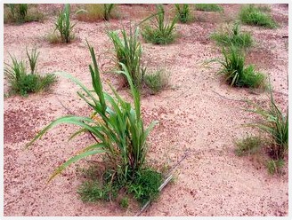
Zaï holes in northern Burkina Faso – Source: http://en.howtopedia.org/wiki/How_to_Start_Culture_in_Zai_Holes
Level permeable rock dams: Level permeable rock dams are long low, dams of loosely-piled rock that are constructed perpendicular to gullies. They prevent their expansion and allow ravines to fill in with sediment so that they can be brought back in to agricultural production. These dams require significant amounts of inter-household cooperation and technical assistance. Like diguettes, level permeable rock dams also promote the spontaneous regeneration of native trees, shrubs, and grasses.
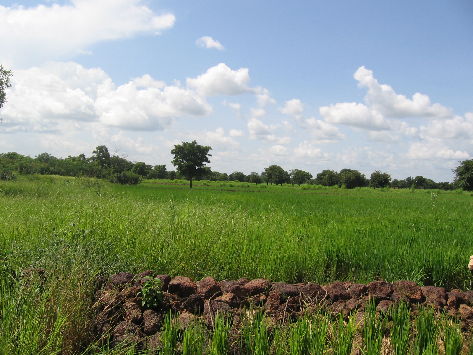
Permeable rock dams and rice fields in Burkina Faso – Photo by Brent Simpson
Land-Use/Land-Cover Change (LULCC): Working with graduate students and researchers at the Institut Géographique du Burkina (IGB – Burkina Faso Geographic Institute), we have used land-use/land-cover change (LULCC) GIS data to understand the consequences of SWC projects on the regional landscape. We combined the Land Use Database of Burkina (BDOT) for 1992 and 2002 along with the West Africa Land Use and Land Cover Trends (WALULCT – http://lca.usgs.gov/lca/sahel/index.php) data for 1975 and 2000 to analyze spatial and temporal trends for the Department of Kongoussi. We hypothesized that SWC investments would result in a reduction of zipellé (bare soil) and an increase in agricultural land.
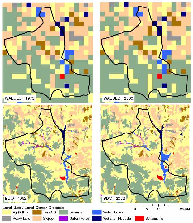
Land-Use/Land-cover Change for Kongoussi: 1975 and 2000 (top) and 1992 and 2002 (bottom) – Source: West et al. submitted
Using ArcGIS and Spatial Analyst, we calculated the percent of each class for each time period to quantitatively assess LULCC over time for Kongoussi. The results indicate there has not been a substantial reduction in zipellé or an increase in agriculture. Instead, there has been a marked stability in land-use/land-cover over the recent short term (1992 and 2002) and the long term (1975 and 2000).
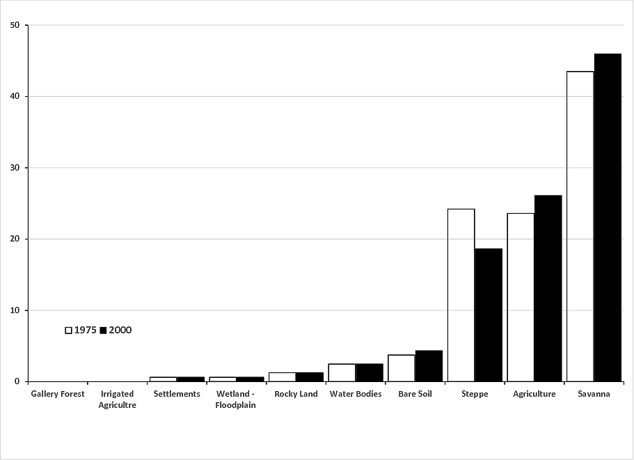
Percent of total area for each LULC class in Kongoussi, 1975 and 2000 (WALULCT)
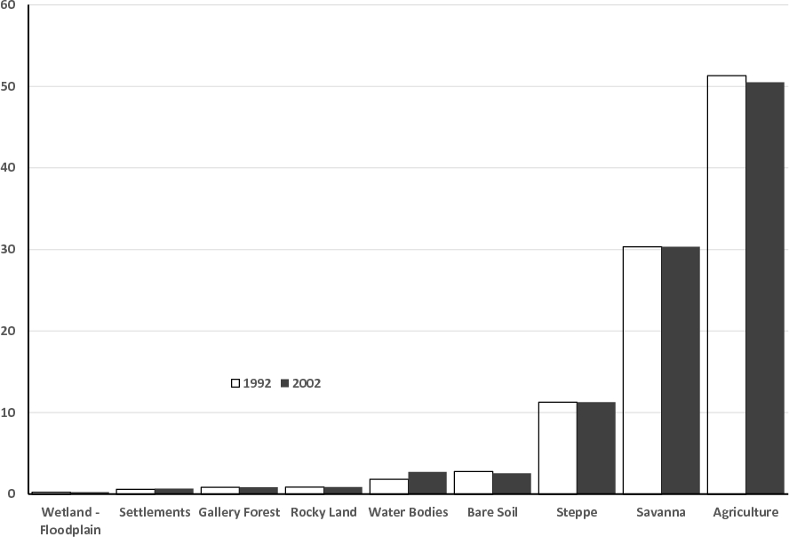
Percent of total area for each LULC class in Kongoussi, 1992 and 2002 (BDOT)
LULCC and SWC: Although these results are provisional, it appears that SWC investments have had very localized impacts and NOT affected the proportion of land-use/land-cover at the scale of larger landscapes. The BDOT and WALULCT datasets, however, are relatively “coarse” and their spatial resolution may not necessarily detect community-level management practices. Finer resolution Landsat or MODIS satellite data and different LULC classification techniques could produce different conclusions.